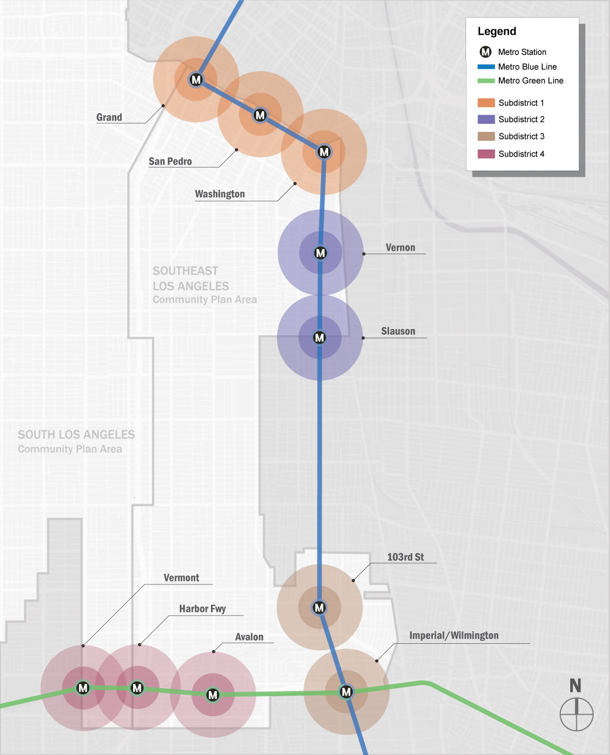
From 2009 to 2012, the City of Los Angeles Planning Department, in conjunction with the National Institute of Health, conducted an urban design study focused on south Los Angeles. Funded by Michelle Obama’s Health Initiative, the study looked at a broad swath of south Los Angeles to determine the potential for increased density, greater urbanization, and large-scale rezoning focused in and around transit lines.
Historically, the Los Angeles metropolitan area has been defined by its low density, urban sprawl and automobile-dependent landscape. However, recent public investment in infrastructure and the continuing development of public transit alternatives (a proliferation of surface light-rail lines, the planning/design of subway extensions to the north and south, west to the beach) point towards a denser urban environment.
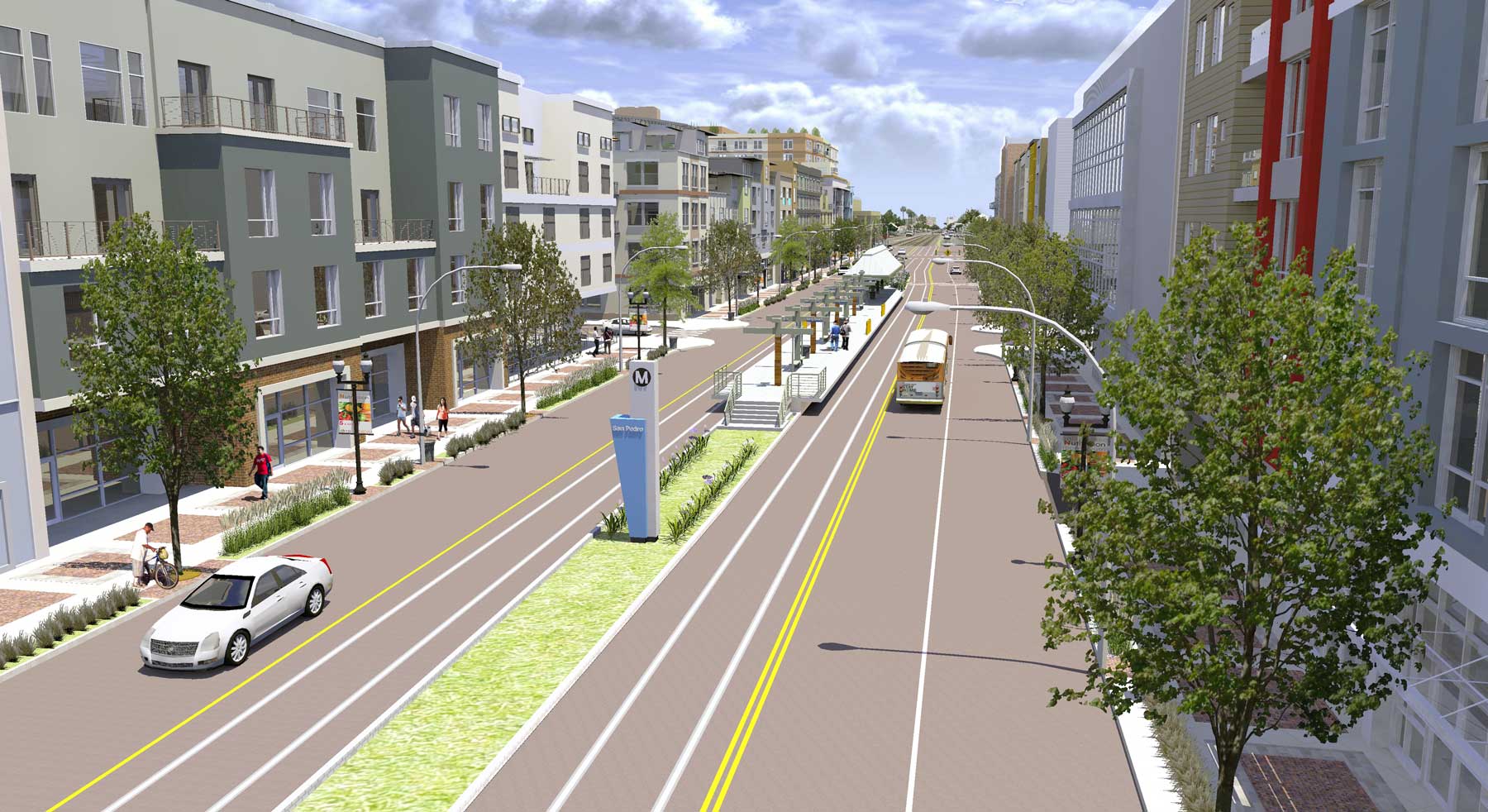
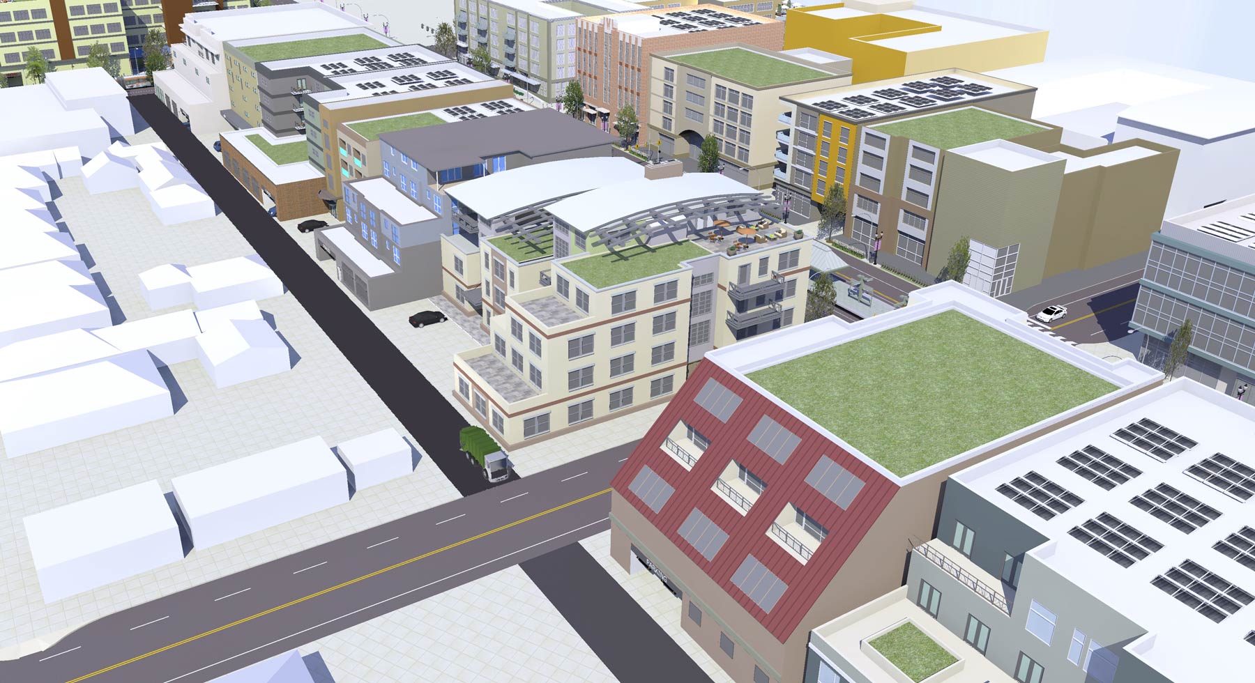
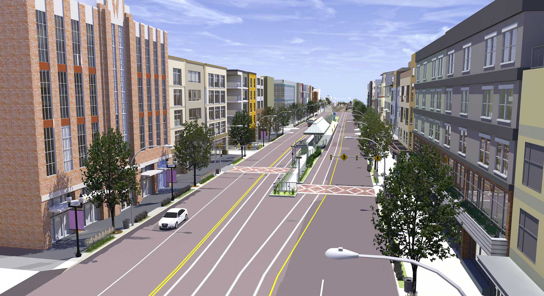
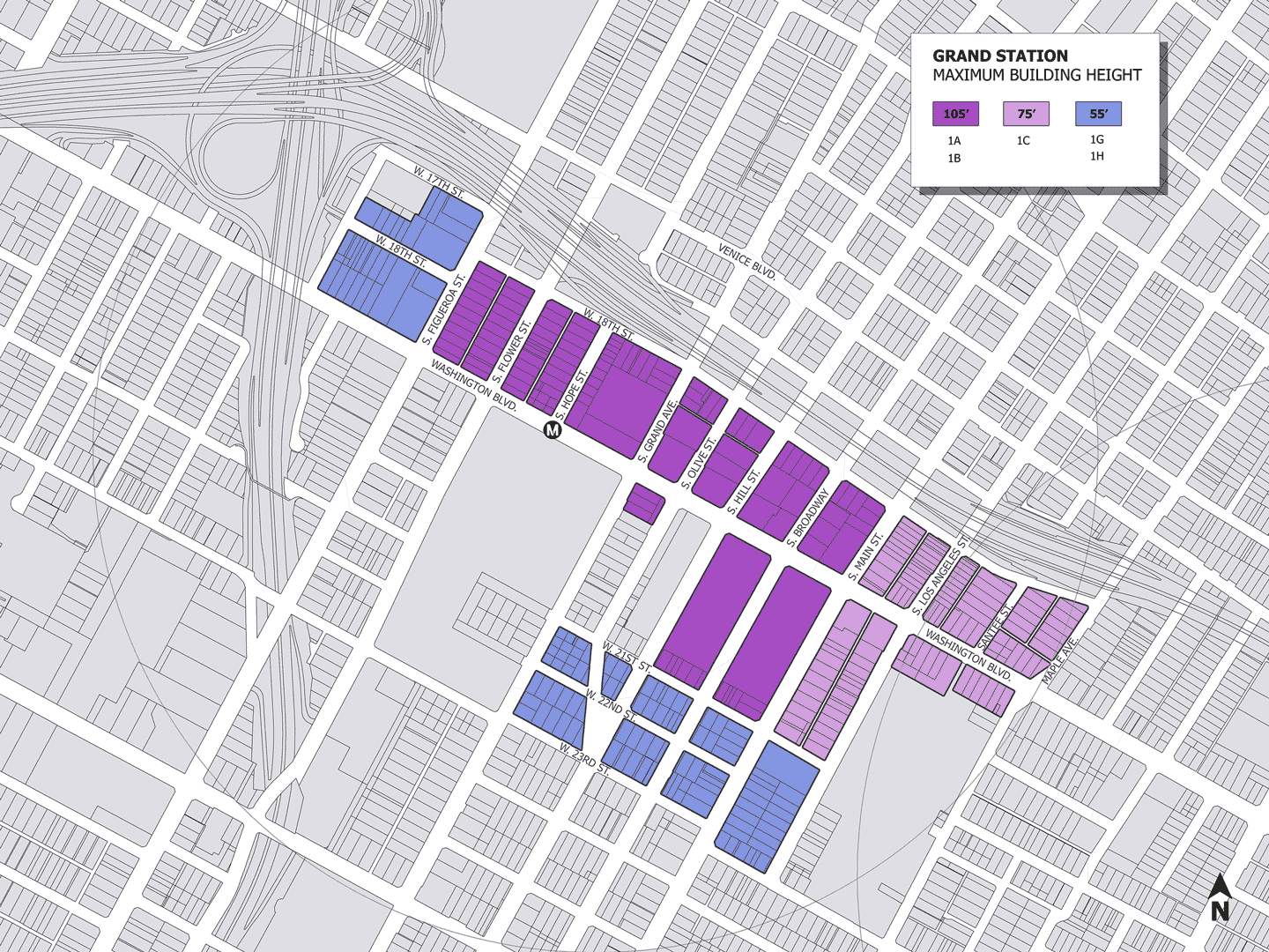
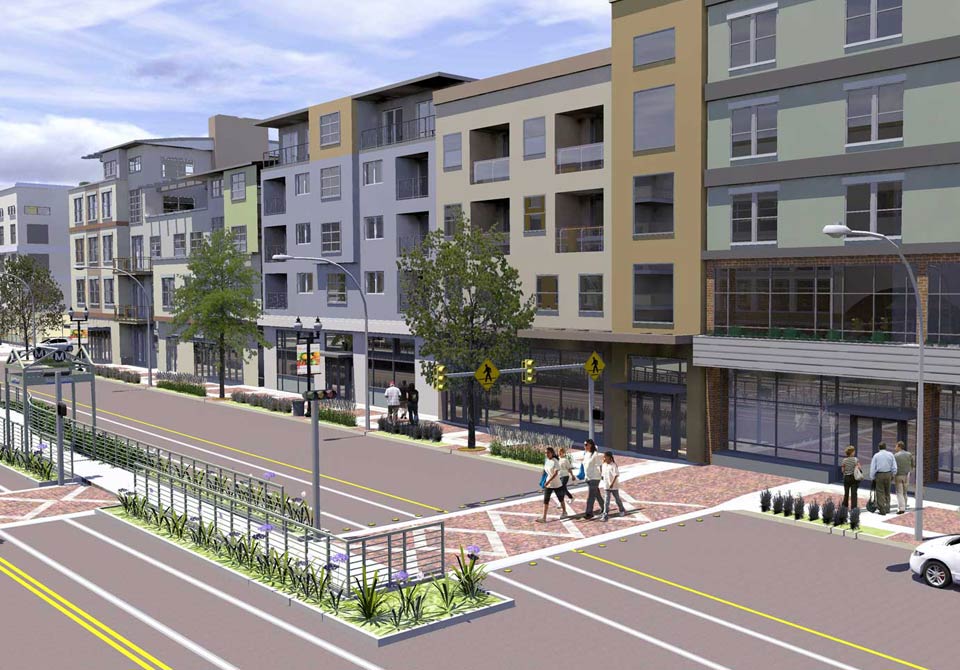
Conscious of the limits of low-density development, Urban Design LA codified new zoning regulations and land-use patterns focused on light rail stations. Based on the proposed zoning regulations, my task was to ‘build out’ neighborhoods to visualize the maximum density allowed by these proposed changes to the zoning code. The mixed-use developments I designed were conservatively tailored in recognition of the fact that these density studies would be presented to the public and to the City of Los Angeles Planning Commission. The following images display how developers might realistically respond to the new zoning regulations.